Finding wild rivers with AI
A citizen science project combining AI and satellite images to evaluate rivers' wildness.
Wild rivers are an invaluable resource that play a vital role in maintaining healthy ecosystems and supporting biodiversity. Rivers of high ecological integrity provide habitat for a wide variety of plant and animal species, and their free-flowing waters provide a large number of services such as freshwater, supporting the needs of local communities. Protecting wild rivers is essential to ensure long-term global health, and it is our responsibility to develop management schemes to preserve these precious habitats for future generations.
Wild stretches, supporting the highest levels of biodiversity, are disappearing globally at an extremely fast rate. Deforestation, mining, pollution, booming hydropower dams and other human infrastructures are built or planned on large rivers. The increasing pressure of human activities has been causing a rapid decline of biodiversity and ecological function. We should act now to protect the rivers and be guided by the current state of rivers to identify unprotected areas that are worth being included in conservation plans. However, there is still no map of global wild river segments which could support such global conservation planning, nor a tool to monitor the wilderness of rivers over time under global changes.
How we find wild rivers, evaluate their wildness, and why we need your help
We will evaluate the level of wildness of river sections from satellite images. Remote sensing is the most efficient method for monitoring the landscape on a global and dynamic scale. Satellite images contain valuable information about the river's course, width, depth, shape and surrounding landscape, which allow us to assess how wild they are visually.
You and other citizen scientists can help us score the wildest river sections from satellite images. Using the ranking from citizen scientists, we will run a ranking algorithm to give each image a wildness score depending on the many pairwise comparisons. These images with a wilderness score will act as a training dataset for a machine learning algorithm which will be trained to automatically score any large river segment, globally. With an accurate river wildness model, we will be able to quickly assess the wildness of the global river sections. Using such a tool, we can for instance find the river sections that are still worth protecting. This pristine river map will provide invaluable insights for conservation initiatives and enable targeted actions to safeguard and restore the remaining pristine rivers and monitor the trajectories of rivers around the world.
How to do it?
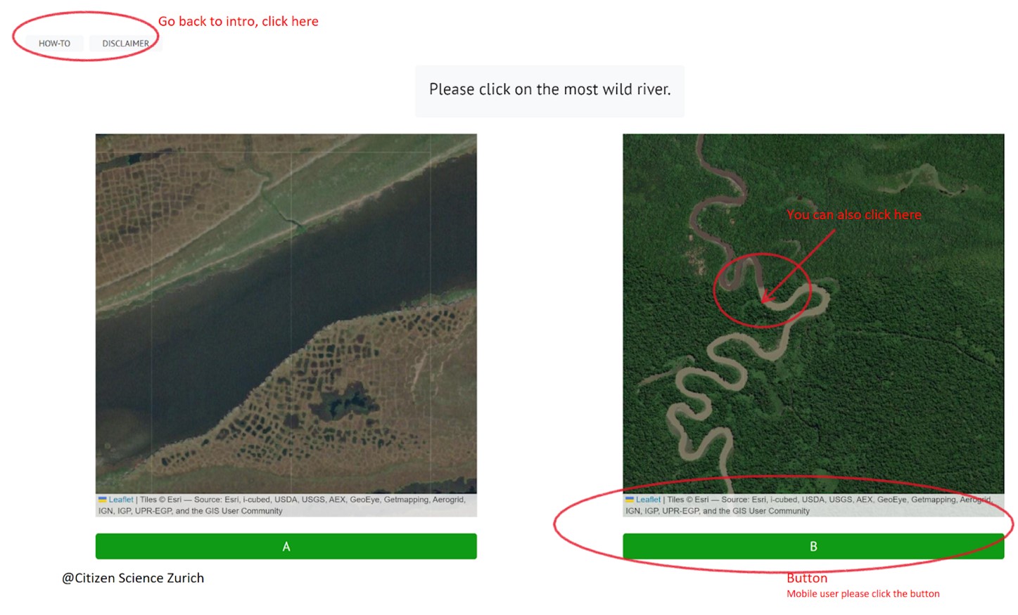
Rivers will first be segmented into river sections with the surrounding environment as a whole landscape bounding box. The river sections will be identified by citizen scientists and your interpretation to form a reference dataset. The game (you can click the corresponding language to access it with different language versions. external page English, external page French, external page German, external page Spanish, external page Chinese) is easy (thanks to external page Citizen Science Zurich); you just have to click on the riverscape you find more wild, or click the button under the rivers. For mobile users, please use the buttons.
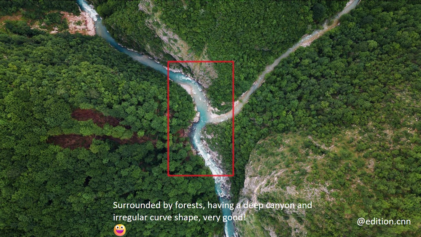
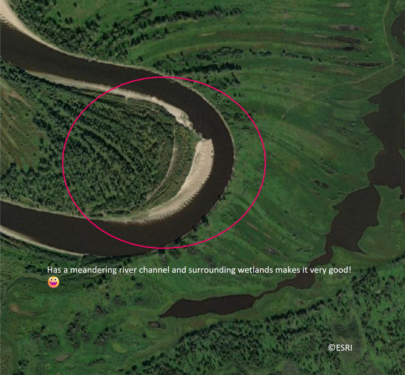
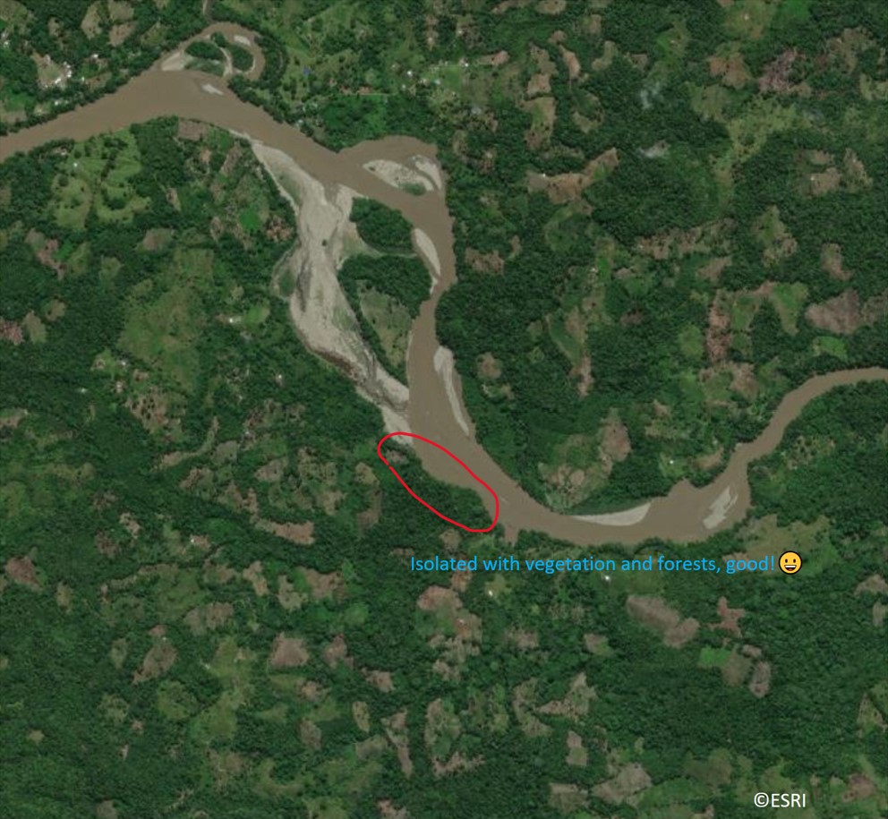
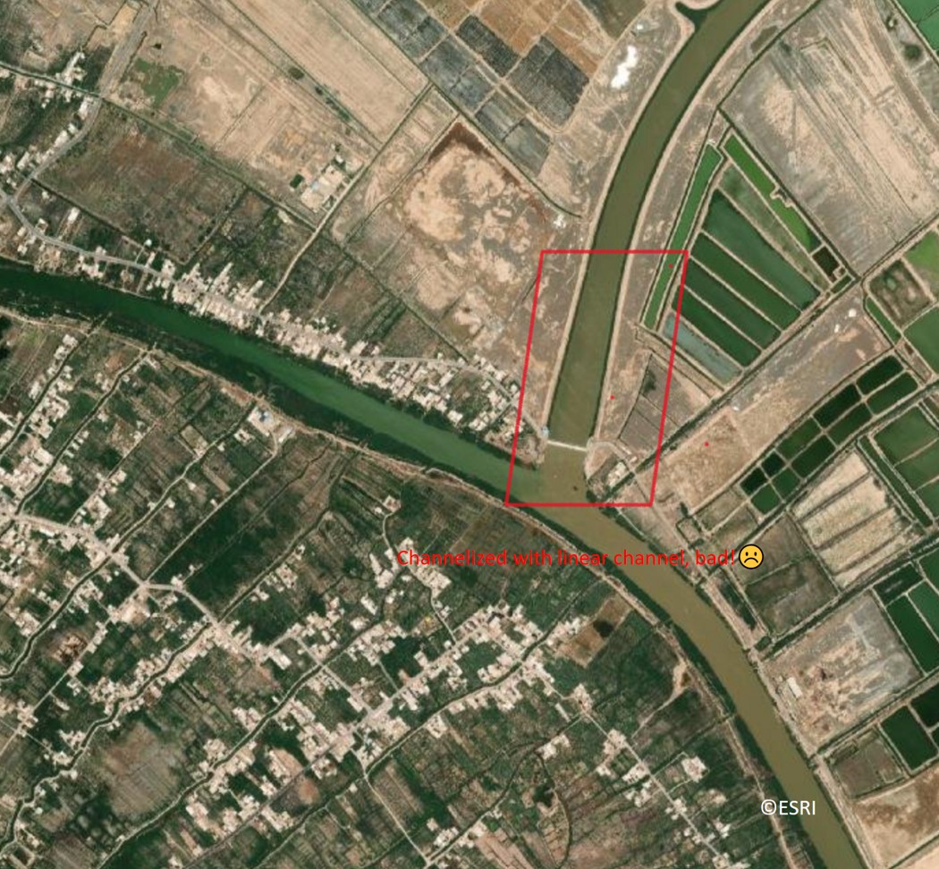
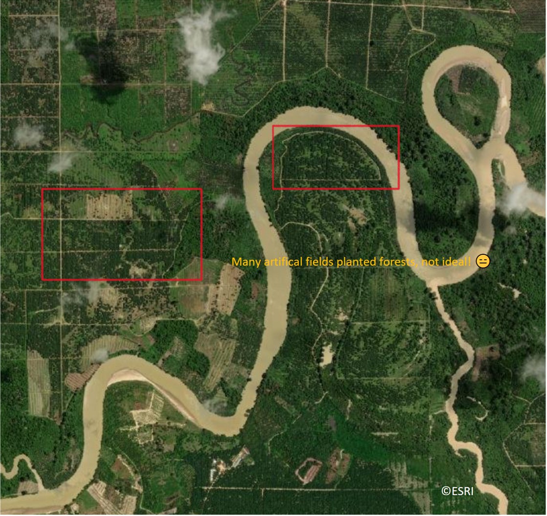
Below you can find some examples of wild or disturbed rivers